
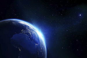
Google Earth: 3D view
With the software Google Earth you can explore the whole world in impressive resolution. The program even has a 3D view and you can customize it to suit your preferences. It's pretty easy to do.
How to set up Google Earth
The software Google Earth is free and runs on Windows and Macintosh computers. You can explore the earth and enjoy appealing satellite images. Thanks to a 3D view, the pictures a very realistic impression. In the settings of Google Earth you can change the 3D view in several areas.
- Start the Google Earth software.
- In Windows or Linux, first click on "Tools" and then select "Options". If you are using the program on a Macintosh computer, you must first click on "Google Earth" and then select "Settings".
- Next, select the 3D view. Various settings are now available in this menu.
The various settings of the 3D view
- The first entry is "Texture Colors". Here you can specify how many bits are to be used in the representation. The 32-bit setting gives you a more realistic view of the earth.
- Next to it is anisotropic filtering, which is best set to "High". This will put more stress on your computer, but it will produce a softer image. If you do not have a fast gamer computer, you should leave the setting on "Off".
- The third point in the 3D view is "Labels / Icon Size". If you are increasingly looking at urban areas, the setting "small" is suitable. "Medium" is suitable for larger rural areas and cities. Select "Large" if you want the lettering to be clearly visible from a distance.
- The "Graphics Mode" comprises the two rendering methods OpenGL and DirectX. If you are using Google Earth on Mac or Linux, select OpenGL. DirectX makes the most sense on Windows. If there are problems with the display, use "safe mode".
- With "Show Lat / Long" you set how the coordinates are to be displayed. Degrees, minutes, and seconds are best. With "Show Elevation", of course, you use "Meters, Kilometers". You should only activate antialiasing if your computer has a fast graphics card.
- Terrain Quality and Map Size also depend on the performance of your computer and can be adjusted using sliders. The higher the setting of "Terrain Quality", the more details are shown in the 3D view. With "Map Size" you can adapt the map size to your preferences.
Install Street View - that's how it works via Google Earth
Since the introduction of Street View, seeing big cities seems essential ...
How helpful do you find this article?